Appalachian Trail: A Backpack and a Book Review
by Will Skelton
I have always been curious about one short portion of the Appalachian Trail which stands out in its potential for a loop hike. Take a look sometime at an end-to-end AT map; the trail is by and large an unrelenting north to south line. However, in one place you will see that the AT almost loops back onto itself. That odd curve is around Standing Indian Basin, and is located just north of the Georgia-North Carolina state line. More detailed maps tell you that it is only 2.3 miles from the Forest Service's Standing Indian Campground up to the AT, then 16.5 miles in a huge bend on the AT, and finally only 3.5 miles back down to the Campground. Perfect for that solo AT hike when you want to do a loop and don't have a shuttle. Or, as I found out when I picked up a hitch-hiking AT long distance hiker, perfect for cheating just a bit and eliminating 18 miles of the Trail, including the infamous Mt. Albert "rock climb."
I drive to the Basin late on a Saturday for a three-day backpack. The short and easy hike up to the AT, then southward following the white blazes. Lots of spring white and pink trillium, bluets, and a strange new flower for me, cone shaped with small purple and yellow flowers (maybe heal-all?). Near Mt. Albert I am somewhat surprised to come upon a fellow standing on the AT beside a dirt bike. I blurt out "What the hell are you doing here?" He is defensive, says he's come up a side trail to check on some people at the nearby Shelter. Likely story, of course, but he seems to be having trouble with the bike, like it won't start. I leave him pushing it down the side trail, hoping he doesn't enjoy the experience. As I climb Mt. Albert, it's obvious from the tireprints he tried, and failed, to make it up the steep trail.
On top of Mt. Albert is one of the few remaining fire towers in the Southeast, with accessible stairs to near the room on top. Forever views of the Southern Appalachians in all directions, and a cool breeze. Down below it's humid, hot and sweaty, and with plenty of insects. After the summit the trail becomes a rock climb, descending directly, steeply, down the rocky side of Mt. Albert. Don't know if coming up would be easier, but either way it would be tough.
Below Mt. Albert is the perfect spring, flowing through an old road culvert and cascading below the trail. I camp just inside the official Standing Indian Wilderness, off the trail among the ferns. It's interesting how hikers, with their heads down as they plod along, don't notice things off in the woods. I watch several hikers pass without any clue I am only 150 feet away.
Around noon on Sunday I pull into a ghastly little shelter named "Carter Gap." Constructed mainly of tin, it's better days were far in the past, if there were ever any better days. I love to read the shelter journals and find many hikers agreeing with my assessment of Carter Gap: "I wouldn't stay here if it were pouring down rain. Infested with flies. Speck." On the other hand several entries indicate a "new" shelter 200 feet away. I am curious about the new shelter, look around, and, so brand new it's not listed in any of the guide books, there is a new shelter with a innovative design. Reportedly flown in by helicopter, it has the usual sleeping area but also an extended roof over a cooking area and table. So apologies for all of us who had disparaging thoughts about the state of maintenance of the shelter.
A couple of other Carter Gap journal entries were worth recording. "Mother Nature gave us a great big sloppy wet kiss, good day to be a fish. Hot Foot." And a strange one: "In 1998, four backpackers were convicted for a crime they didn't commit. They promptly escaped from a maximum security stockade to the Fontana Dam underground where they survive today as hikers of fortune. If you need help and if you can find them maybe you can hire...The A.T.eam." And finally, simply, "I have nothing profound to say."
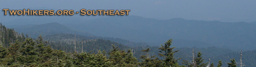
On to the summit of Standing Indian Mountain, where a fire tower once stood and where the weather has eroded the "Standing Indian" rock formation to something I only recognize as a rock. The summit is a grassy area, occupied by a couple and their small dog from Florida. The young man tells me he proposed to the woman, now his wife, one year ago today on the rock outcrop looking southwest toward Georgia. The view is great, layers of green mountains to the horizon, with wisps of fog in the valleys. I leave the newlyweds and move on out the ridge a way to a perfect one-tent site, sheltered by trees and rocks, but with views and some wind to keep the insects moving.
Which brings me to the subject of the insects. Blame it on El Nino says a USA Today article: "Attack of the Bugs: Warm Winter has Wrought a Swarm Spring, Summer...It has become a national pastime to blame everything on El Nino, and the coming plague is no exception." Whatever the cause, I have personally never seen so many insects, and especially nats and common flies, in the Southern Appalachians. Around dusk and dawn, when most backpackers are in camp, they are everywhere, even in the wind on top of Standing Indian. Ultimately the wind prevails; unfortunately it keeps blowing and there are constant hard gusts all night.
So much for insects, what about the book review promised in the title? Well, I'm combining a book review with this article, mainly because I started reading the book on this backpack (I've got a reputation for lugging hardback books on backpacks) but also because the author's hike in the Standing Indian Basin provides an interesting contrast to my experience. A Walk in the Woods: Rediscovering America on the Appalachian Trail by Bill Bryson (Broadway Books, 1998, $25.00) is certainly this season's (there seems to be an "AT book" every year) finest book on the AT. The book has been well advertised, full pages in the New York Times Book Review, and the author made a bookstore tour, stopping in Knoxville in May.
Bryson's book is, first off, about the funniest look at the AT I've seen. Starting with Katz, his obese, 300 pound, quickly arranged hiking companion, who plans to do the trip on Snickers and Little Debbie cakes (Ray Payne, whose backpacking desserts once were exclusively Little Debbies, would have loved hiking with Katz). In the single telephone conversation where they agree to hike together, Bryson inquires about what kind of shape Katz is in? "Real good. I walk everywhere these days." "Really?" This is most unusual in America." "Well, they repossessed my car, you see." "Ah."
Or the cab ride from Atlanta to the AT, when the driver tells of prospective AT hikers who fail (over 80%), like three women from California who fly all the way to Georgia, with tons of gear and months of planning, and turn back after one and one-half miles. Or Bryson's secret desire to tell a trail "gear-head" who loves to talk about equipment and asks what Bryson thinks of the gear-head's brand of backpack: "Well, here's an idea to try to get hold of, Bob. I don't remotely give a shit." And the best description I've seen of a fast food breakfast: "...a greasy, leaden Hardee's breakfast threatening at every moment to come up for air."
Unfortunately, the humor portion of the book drops off after the first half when Bryson and Katz struggle up the Trail to Newfound Gap in the Smokies. On a side trip from Newfound Gap they are seduced by Gatlinburg's dubious charms and decide not to finish, which Bryson spends a lot of time rationalizing. They decide instead to hike "portions" of the remaining AT, which portions turn out to be mainly short hikes by Katz with lots of automobile travel and hikes with Katz in Shenandoah National Park and Maine's "100 Mile Wilderness." So the last part is more philosophy and history, interesting and often right on target but you won't be laughing out loud. Bryson is at his best in the nonhumorous vein when critiquing the Forest Service:
The Forest Service is truly an extraordinary institution. A lot of people, seeing that word forest in the title, assume it has something to do with looking after trees. In fact, no--though that was the original plan...In fact, mostly what the Forest Service does is build roads. There are 378,000 miles of roads in America's national forests...eight times the total mileage of America's interstate highway system. It is the largest road system in the world in the control of a single body. The Forest Service has the second highest number of road engineers of any government institution on the planet. To say that these guys like to build roads barely hints at their level of dedication. Show them a stand of trees anywhere and they will regard it thoughtfully for a long while, and say at last, "You know, we could put a road here."
An especially relevant portion of the book is when Bryson and Katz arrived at the Standing Indian Basin in March of 1996. Snow had begun to fall as they approached Big Butt Mountain and Mt. Albert, one of the toughest sections of the Trail. Cold blowing snow turned their hike into a perilous adventure. "It was deeply unnerving. It took us over two hours to cover six tenths of a mile of trail." And they weren't even to the top of Mt. Albert, which requires what can only be described as rock climbing to follow the trail. In the snow they desperately tried to read their inadequate maps, and finally decided to skip the rock climbing and followed a logging road. Luckily the road led around Mt. Albert, and on to Big Spring Shelter. A cold and windy night followed, with knee-deep snow the next morning. Continued heavy snow led Bryson and Katz to abandon the shelter and struggle down to the road and Rainbow Springs Campground, where hordes of hikers were marooned for the duration. What a contrast to the hot and humid Memorial Day weekend a few months later for myself, doing the same stretch of trail. And a lot more people on the trail in May; I encountered over fifty.
On Monday, from top of Standing Indian Mountain, it is an easy 3.5 mile walk down a long ridge to the campground and car. The headwaters of the Nantahala River then make for a great post-hike bath. Later, a short way up the road, I give the cheating hitch-hiker a ride into Franklin, North Carolina, for a town break from hiking.
© William H. Skelton, 1998