South San Juan Wilderness 2003
High, Wild and Windy
Where ARE we?
Tuesday, September 16
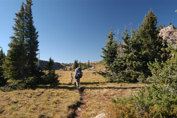 Susie and I were up by 6:45 stuffing our sleeping bags. After a while, there is only so much time one can spend lying on one's back in a tent. It was still breezy outside, but it was time to get up and face it. We rolled a tad before 9 am, picking our way across the open meadows and forest east-southeast toward the obvious promontory at the SE corner of the cirque that holds Green Lake. As mentioned, the trail climbs the promontory fairly steeply, but it was only a short, 200 foot climb before things start to level out. And then it opens into the glory of miles and miles of high, alpine meadows. We followed rock cairns along, trying to keep up with Tim and Diane, who, after about 1.5 hours out of camp, had stopped on a small point to drink in the view. We all opted for following Lance's lead, and got down behind a small rock wall that afforded a bit more protection from the breeze. (See a developing theme here?) Out of the wind, the sun took control, and warmth was seeping back into our bodies. Andy and I got out our GPS units and took a fix. I made a minor fool of myself by exclaiming that this was another example of signal bounce, since the GPS had us sitting nearly 750 meters to the east of where the trail was going, and of course, we had been faithfully following the trail. Right? Well, as Hertz likes to advertize, "Not exactly." Yes, we had been following the cairns, but the fact that Andy's GPS had us in the same place gave us pause to start taking a harder look at our immediate surroundings. We saw a huge cairn to the immediate east, maybe 150 meters to the northeast, and there were a couple of small ponds right to our east. It started to dawn on us that in fact, the GPS was dead on, and we really were at 359874 Easting, 4114005 Northing. Apparently, the path was not as marked on the map. Once we saw where we really were, it was clear why we could not see Trail Lake: it was about 60 feet higher than we were and about a kilometer to our southwest. Basically, by heading directly toward the cairn, we would regain the trail, and knock about a half-mile off our route.
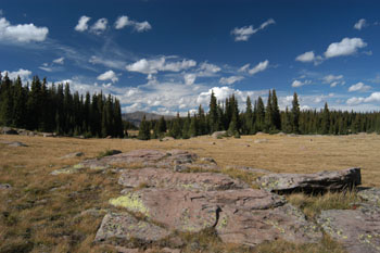
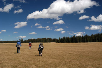 And so after a rest, such is exactly what we did. And it was interesting, as soon as we headed northeast along the crest of this plateau, the vegetation changed dramatically. Gone was the lovely golden grass, replaced with this ugly brown stubble. But, at least we were headed in the correct direction, toward Victoria Lake. Now, the "trail" - basically a compass heading, was faint at best. We were headed to Victoria Lake. It felt good to walk in a generally northeast/easterly direction, since it put my pack between me and the wind. Near 362203 Easting, 4114504 Northing, the route splits if you are headed to Victoria Lake. The trail to the northeast does not show up on the USGS topos, but does show up on the National Geographic/Trails Illustrated Map. It heads through deep woods and becomes very easy to follow, like a real trail. We were moving slower than the lead crew, so Susie, Ray, and I opted to stop for lunch in a lovely little open area sheltered from the wind, near a big talus slope. We listened to the pikas screech as we disturbed their peace. When Ray took off his pack, he just flopped down on the grass in the sunshine. I don't think I have ever been on a trip with him when he took it easy as much as he did on this one. Sorta like the rest of us mortals, only older! After lunch, we quickly caught up with the rest of the crew, waiting patiently for the slowpokes at the very next opening. Everyone knew they were relatively close to the end of the hike for the day, even though it was to be our longest, so no one was in much of a hurry.
 After lunch, we began the descent to Victoria Lake, a huge talus slope to our right. A quick 200 foot descent brought us to the edge of this gigantic meadow that stretched more than a mile to the south. We scouted the west side of the lake, thinking that such might provide us with better protection from the wind. But the sites were not as nice as we thought we could see on the east side of the lake, so we decided to hoist one more time and pick our way across the marshy meadow, Sue having found a place where we could hop across the inlet stream to the lake. We poked around for a bit, finally settling on a spot about 1:45 pm at the NE corner of Victoria Lake, near 13S, 363901 Easting, 4116298 Northing. We did not have perfect shelter from the wind, but it was sufficient to make things tolerable. Susie spent a lot of time deciding on exactly where we should camp, this being the first spot where we could really have a long view. It was a decidedly lovely spot on a decidedly lovely afternoon, had it not been for the wind. After we got settled, about 100 meters back from the shore in some scattered trees, I decided to take Susie's advice, and bathe out of the gale that existed down by the lake. It was so windy that it was an effort just to get more than about 20% of the water you were trying to pour into the water bag to hit the opening. The rest would just blow away. It was nice to have a bit more protection for cleaning up. It meant getting more water at the lake, but it felt good to be clean, and while the sky was filled with big puffy clouds, there was enough sun to keep the temperature tolerable.
 The afternoon was spent in various non-productive pursuits. Susie opted for getting in tentia, and reading and napping. I decided to take a little walk to the NE of the lake and do some photographing and chatting with the rest of our party, and some cattlemen that were out looking for some of their charges. They were the first people we had seen since yesterday afternoon. We encouraged Tim to take a shot at fishing the outlet stream, but he had no success. This kind of weather is just not conducive to fish nibbling. The wind was pretty insistent. Lance's tent - behind a tree break, no less - already had collapsed one time and there was a minor pole bend. We all decided to start dinner fairly early, around 5 pm, just to get things out of the way. We found a small break in some trees, and most folks put their backs to the breeze. It did not make for as social an arrangement as a circle, but it made sitting out more tolerable. Dinner for us was Four-cheese instant potatoes with dried ham and green beans, and it was a nice break from pasta. We built a little fire, after fortifying an existing fire ring to provide greater wind protection, and burned up some trash, before retiring to our respective tents, where Susie and I enjoyed a short slide show of the last couple of days worth of photos on the 1.2 inch screen on the back of the digital camera.
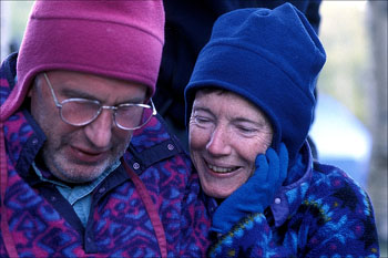
© Roger A. Jenkins, 2003; Roger & Susie photo © Andrew P. Butler, 2003