Paria Hackberry Traverse 2008
Ch-ch-ch-ch-Changes
Willis and Sheep Creeks
Sunday, April 27 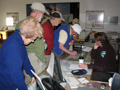 With a fine, grocery store-based breakfast of motel room
coffee, yogurt and granola, and Sunny Dee as a substitute for real
orange juice, we finished stuffing Ray's tiny Chevy Cobalt, A&S's
rented Jeep Liberty, and our Highlander with everyone's gear, both
hiking and otherwise. (Ray had decided that he would only day hike
with us to the confluence of Willis and Sheep Creeks on this day,
rather than do a shortened backpack. We were disappointed that he
would not be joining us for the first few nights of the trip, but once
one get's into one's mid-70's, you have to draw the line somewhere.)
We left the motel by about 8 am and headed for Cannonville and the
GSENM Visitor center to pick up a permit for the backpack. We had
expected such to be a 5 - 10 minute effort, but the entire process
took 30 minutes. Our first, and only real, problem was that the
"ranger" - for lack of a more appropriate title, told us that we
"really shouldn't" be using the administrative road that goes out
across Slickrock Bench. (Our plan had been, on the last full day of
the trip, to camp - waterless - near the confluence of Round Valley
Draw and Hackberry Canyon. Then, the last morning, we had planed to
hike a half mile to a crack on the north side of Round Valley Draw,
which is supposed to be a scramble climb up to the rim, and walk about
300 meters or so to where the car was parked.) Not being able to use
the road out along Slickrock Bench would preclude that exit. I had a
Plan B in mind - exit going out Hackberry to near the Cottonwood wash
road - but I was a little annoyed that we had been told a month ago by
someone in the Visitor Center that we could use the Slickrock Bench
road and now, we were being told the opposite. However, I held my
tongue and was polite. I just wanted to get our permit and quit
screwing around and start what would be now a more convoluted car
shuttle.
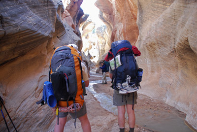 A little after 8:30, we were
finally on our way. Normally, how we would have run the car shuttle
would be for everyone to drive to the ending trailhead (now, in this
case, the end of a supposed administrative road that we HAD received
permission from the GSENM "ranger" to use that left the Cottonwood
Wash Road 4.7 miles past the turn off to Kodachrome Basin State Park),
drop off the shuttle vehicle, and then drive to the starting
trailhead. However, without a cargo vehicle, and our existing vehicles
stuffed to the proverbial gills with gear and people, such a simple
approach was not possible. So we headed south from Cannonville on the
paved -at this point - Cottonwood Canyon Road, and turned off the
pavement at about 2.9 miles on to the dirt and sand Skutumpah Road
toward the Willis Creek trailhead, 6.3 miles from the pavement. Now
theoretically, you can do this road with a sedan (Ray, masterful
driver he is, was able to make it), but the steep climbs through sandy
sections suggest that an all-wheel drive, higher clearance vehicle
will make one feel more comfortable.
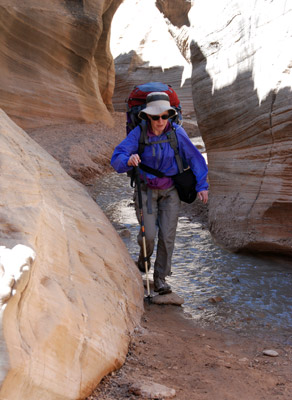 At the Willis Creek Trailhead,
on the right heading south, just before the road crosses the creek, we
disgorged all the packs, and moved some crap to Ray's vehicle. Then,
Andy and I took off in our respective vehicles, and headed back to the
Cottonwood Canyon/Wash road, then on the pavement as far as the State
Park. 4.7 miles past the turn off to the State Park (there are a
couple of "interesting" spots on the Cottonwood Wash Road in those 4.7
miles), there is what passes for a road, but is really a 4WD track off
to the right. We turned down that road, and immediately started
wondering if we were in over our head. The road is mostly sand, and
deeply rutted, and had plenty of sagebrush bushes grown in it. There
is NO WAY I would even attempt this route without a high clearance,
4WD vehicle. The "ranger" had told us to park near the corral, but we
did not get that far, opting to pull off in a flat area, where people
had camped, near 12S, 417937 E, 4146820 N. (Note that all the
waypoints given in this report use the NAD 27 CONUS grid. Yes, I know
that WGS84 is more modern, but a lot of folks still refuse to come
into the 21st Century and use digital topographic maps, such as those
sold by National Geographic and instead use paper maps, which are
forever wedded to the NAD 27 grid.)
Then, I hopped into Andy's Jeep Liberty, and headed back to Willis Creek. We arrived at about 10:35 am, so it takes a while to run this short (20 miles one way) car shuttle. Most of the crew had left the trailhead, but our long-suffering spouses, Susie and Sue, were waiting, albeit not too patiently, for us to join them. Finally, at 10:45 am, we started hiking.
The route starts behind a "trail" marker, on the east side of the
road, on the north side of the creek. It does not take long for the
path to drop into the creek bed, and the narrows begin. It was easy to
see why this route is so popular among day hikers. It requires no
canyoneering to get into the narrows, and they are nice but not
claustrophic. The four of us hopped the nice stream running through
the narrows, and took lots of photos. What a great way to start a week
long backpack. Despite all the picture taking, we ran into the rest of
our group, including day-hiking-Ray, at the mouth of Willis on Sheep
Creek. We were impressed with our time, it having taken 1.5 hours to
go the first 2.4 miles. It was a good place to stop and eat my meager
lunch. 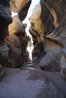 Susie and I had decided, since
this would be our first truly seven night backpack in five years, to
really work hard to pare down our food. Indeed, we had been
successful, starting with only 18 pounds between us, way less than the
"Holy Grail" weight of 1.5 pounds per person per day. But I have found
over the years that I tend to pack more lunch than I really want to
eat, especially if there is to be significant physical work in the
afternoon. All I am looking for is a bit of something salty, in this
case, good-tasting crackers and cheese, and something sweet, like
M&M's.
While we were finishing lunch, we heard the sound of a vehicle coming up Sheep Creek and I grabbed my camera, hoping to record some ATV's violating the law and turning up into Willis Creek. Instead, it was Ranger Bob Stoner driving a 4WD truck. Basically, he and another guy were out looking for ATVers breaking the law.
An aside, here: many short-sighted locals really hate the fact that the all of us US Citizens, through the Federal Government, own a lot of land in Utah. When the Grand Staircase-Escalante National Monument was formed, many locals saw this as a "land grab" by the Feds, rather than an opportunity to rebuild the local economy on something (in this case, tourism) that is likely to have a future, rather than the boom and bust cycles of resource extraction. A couple of the counties in Southern Utah have removed signs put up by the BLM, closing what some people called roads, but what most people with an objective view would say is only "evidence that some sort of vehicle has passed through sometime in the past twenty years." You can read about some of the litigation here.
 But the bottom line is that many folks use
ATVs to travel the Upper Paria and Sheep Creek corridors, claiming
that this has been an historically open vehicle route, since the days
when they used horse and buggies to travel from Cannonville to Kanab.
While the litigation is on-going, vehicles are not prohibited from
traveling along the Upper Paria and Sheep Creek corridors. But they
are prohibited from going a lot of other places, and many ATVers feel
like they should be able to go anywhere their machines can take them,
irrespective if that travel is sensible, appropriate or legal. Many
ATV clubs will make the "a few bad apples" argument, but I get really
tired of that. If they cannot police themselves, then all ATVs need to
be prohibited from sensitive areas. I could go on and on, but the
point is pretty obvious: you don't take a dump at the pulpit of a
gothic cathedral in Paris, because it is inappropriate behavior for
that kind of place. And you don't drive ATVs in environmentally
sensitive spots, because THAT is inappropriate behavior.
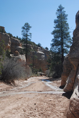
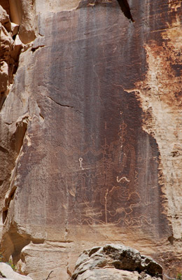
Anyway, we had a pleasant discussion with the ranger, and it was clear that his patience for people violating the law in this kind of area was pretty limited. The ranger reported that there was water flowing all the way to the Paria. So we talked among ourselves and decided, since tomorrow was scheduled to be a layover, with the focus on a day hike up Bull Valley Gorge, anywhere downstream of Bull Valley's mouth where we could find a suitable campsite would be a good place to spend a couple of nights. So we bid our adieus to Ray, wished him safe travels, and left the lunch spot, heading down Sheep Creek. There is a nice petroglyph panel slightly downstream (canyon right) from the mouth of Willis Creek that is easily visible from the Sheep Creek streambed. We took photos and hiked on, noting the lovely white Navajo sandstone layer, and the little notches that held huge Ponderosa Pines at this elevation.
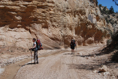
 But the walking was tough, and
the day was heating up. It turns out that most of the Sheep Creek
stream bed is loose, soft gravel. So when one is wearing a heavy pack,
and you push off to take a step, a large fraction of your effort goes
to pushing back gravel. This is ok, if it would have been a few
hundred meters. But it turns out that this is pretty much the way it
is all the way to the mouth of Sheep Creek. We caught up to Andy and
Sue, Ron and Terri and took a rest break in some welcome shade. I
could tell already that Susie was not happy. She tends to do great in
the mornings, but when the day heats up and the muscles get tired, her
outlook can sour. I have learned, from years of experience, that "this
too shall pass." It usually does.
We pushed on, noting the scenery, but saving our energy. Maybe the packs were getting heavy, but it was feeling, with the loose gravel, more like drudgery than hiking. We got to the mouth of Bull Valley Gorge, and saw only Ron's pack. So I mistakenly figured that Sue and Andy were ahead, looking for a campsite. The problem was that while we did have flowing water, the further we got down Sheep Creek, the muddier the water became and the less of it there was flowing. Hmmm...... Now, I remembered that Kelsey indicates that about a half mile above the mouth on the Paria, water begins to flow in Sheep Creek. I thought to myself: maybe if water is starting to flow a bit further downstream, it would be a lot cleaner. We could find a seep or a spring or something. So, Susie and I pushed on, mistakenly thinking that A&S were ahead (we would later learn that they had both turned up into Bull Valley Gorge to look around and dropped their packs in the Gorge), despite the fact that both Susie and I "were ready to be there." We crossed a couple of benches and eventually arrived at what would end up being our campsite around 3:30 pm. Since we still had not confirmed that A&S were behind us (I suspected that they were), I told Susie to relax (boy, talk about wasted words), while I took off downstream to confirm a) that we were at the lead for our group and b) that this was the best place to camp within this canyon stretch. I arrived back in camp about a half hour later, and confirmed both items, so we were home for the next two nights. The campsite itself is a broad bench, maybe 12 feet above the streambed level, dotted with a few Ponderosa Pines. It is sandy, but had good late afternoon shade, and the best thing about it was that there is clean flowing water coming out of the ground right across from the campsite (12S, 407771 E, 4142377 N.)
 Certainly my mood, and Susie's
as well, began to improve as soon as we went downstream, bathed, got a
bit of food in us, and had a shady spot where Susie could get in the
tent, away from the few Noseeums that had already managed to locate
her. Dinner time is always an occasion to discuss the day's events and
give each other a hard time. Tonight was no exception. First, we
laughed at ourselves calling our dinner Dirty Rice with black beans
and ham. Rice?? Boy, at the prices of rice these days, there is little
of the stuff in prepared mixes. Mostly pasta. Not bad, but not rice.
Then there was Will and his stove. He had brought his classic Svea
along, to heat water for he and Carol. Except the stove would not
work. He would light it, and it would sputter and stop. We offered,
since we were done cooking, to let him use our stove and then he
confessed he had washed the fuel tank out with water before he flew
out here, just like the TSA recommends. Then someone remembered that
Sveas use a wick, and of course, Will's wick was wet with water (say
that fast three times), since he had not bothered to dry it out prior
to the trip. That started an immense amount of guffawing. Hey, I was
just happy that I had brought my heavy fleece jacket. You could tell
the night would be cool.
To view supplemental photos of this trip, go to our TwoHikers SmugMug gallery.
To view additional and different photos of the trip, go to Will's SmugMug photo gallery.
© Roger A. Jenkins, Suzanne A. McDonald, 2008, 2016. Photo of permit process © William H. Skelton, 2008
